Lemland weather: forecast and climate
Today's forecast for Lemland is shown below and updated every 30 minutes. The climate is maritime: at the Finnish Meteorological Institute's Lemland Nyhamn station the mean annual temperature is 7.0 °C (1991 to 2020 normals), with February the coldest month at -1.1 °C and August the warmest at 16.9 °C.
Lemland weather right now
- Today12° / 8°4.4 mm
- Saturday 24/1012° / 7°0 mm
- Sunday 25/1011° / 10°0 mm
- Monday 26/1011° / 10°0 mm
- Tuesday 27/1011° / 9°0 mm
- Wednesday 28/1011° / 10°0 mm
Where can I find today’s weather in Lemland?
If you are after the weather right now or the forecast for the next few days, go straight to one of these services:
- Finnish Meteorological Institute (FMI), Finland’s national weather service: weather in Lemland. FMI has its own observation station in the municipality, Lemland Nyhamn.
- SMHI, the Swedish weather service: forecast for Lemland (in Swedish).
- yr.no (the Norwegian Meteorological Institute and NRK): forecast for Lemland, with an hour-by-hour table.
- Sea ice in winter: FMI ice conditions.
The rest of this page is about the climate: what to expect on an ordinary January or July day in Lemland.
What is the climate like in Lemland month by month?
The table uses FMI’s climate normals for 1991 to 2020. For the Lemland Nyhamn station, FMI publishes only the monthly mean temperature. The average highs, average lows and precipitation therefore come from FMI’s Jomala Jomalaby station on the Åland main island, which has full statistics. The gap between the two stations says a lot about how the sea shapes the weather.
| Month | Mean Nyhamn (°C) | Mean Jomalaby (°C) | Avg high Jomalaby (°C) | Avg low Jomalaby (°C) | Precipitation Jomalaby (mm) |
|---|---|---|---|---|---|
| January | 0.2 | -1.4 | 0.9 | -4.0 | 53 |
| February | -1.1 | -2.4 | 0.4 | -5.3 | 36 |
| March | 0.4 | -0.2 | 3.2 | -3.3 | 34 |
| April | 3.2 | 4.0 | 8.3 | 0.3 | 31 |
| May | 7.7 | 9.2 | 13.8 | 4.4 | 37 |
| June | 12.4 | 13.6 | 17.9 | 9.0 | 56 |
| July | 16.7 | 17.0 | 21.2 | 12.5 | 48 |
| August | 16.9 | 16.3 | 20.4 | 11.9 | 65 |
| September | 13.1 | 11.9 | 15.6 | 8.3 | 64 |
| October | 8.3 | 6.9 | 9.7 | 4.0 | 74 |
| November | 4.6 | 3.1 | 5.2 | 0.9 | 68 |
| December | 2.1 | 0.4 | 2.5 | -2.0 | 62 |
| Year | 7.0 | 6.5 | 9.9 | 3.1 | 628 |
Source: FMI, 1991 to 2020 normals. Parts of FMI’s statistics pages were missing in October 2026, so the figures come from an archived copy of the same pages.
How does the sea affect the weather in Lemland?
Lemland is mostly water: of the municipality’s 965 km², 852 km² is sea, according to Wikipedia. The sea is never far away. The numbers show it. The sea stores summer heat and releases it slowly through autumn and early winter: in October the mean temperature at Nyhamn is 8.3 °C against 6.9 °C at Jomalaby, and in January Nyhamn sits at 0.2 °C while Jomalaby is at -1.4 °C.
In spring it works the other way. The water is still cold and Nyhamn lags behind: 7.7 °C in May against 9.2 °C at Jomalaby. At Nyhamn, August is even marginally warmer than July.
For a visitor, that roughly means:
- Summer (June to August) is mild rather than hot. Mean temperatures are around 17 °C in July and August, with average highs just above 20 °C inland.
- Autumn is long and fairly mild but wetter. October is the wettest month at Jomalaby, with 74 mm.
- Spring is dry (31 mm in April) but cool on the coast, especially when the wind blows.
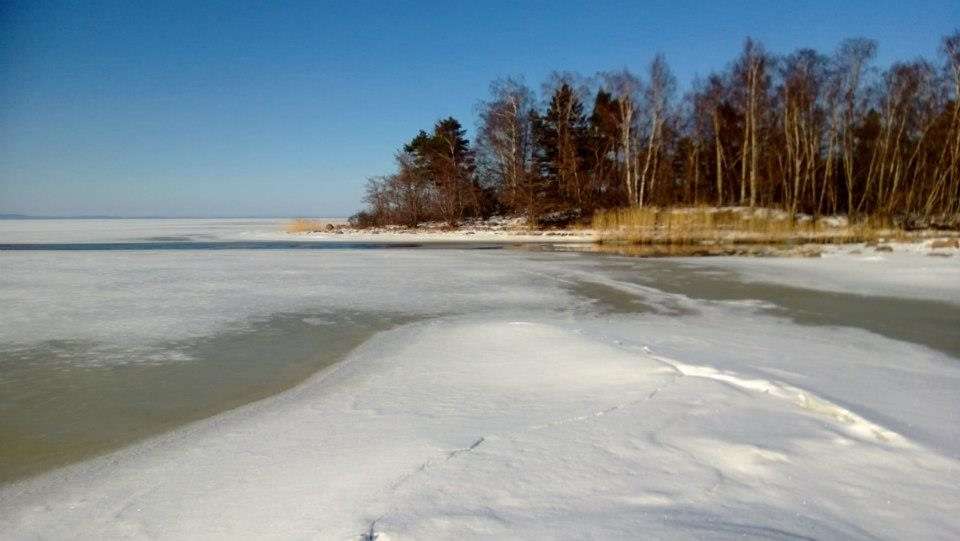
- Winter hovers around freezing. Snow and frost come and go, and in some winters the sea freezes.
How light are the summer nights?
The Åland Islands lie at about 60 degrees north. According to the sun tables for Mariehamn on gaisma.com, the sun rises at 4.15 am and sets at 11.09 pm at midsummer, almost 19 hours between sunrise and sunset. At the winter solstice the sun rises at about a quarter to ten and sets at half past three, and the day is just under six hours long.
Does the sea freeze around Lemland in winter?
It varies a great deal from one winter to the next. According to FMI, the ice season in the Baltic normally runs from November to the end of May, and in an average winter the Archipelago Sea is among the areas that freeze. In mild winters the ice cover is much smaller: in 2020 the Baltic had the smallest maximum ice extent FMI has recorded, 37,000 km².
When the ice does form, it becomes part of winter life in Lemland, and the municipality’s own photos show ski tracks out on the sea ice. But sea ice is treacherous. Check FMI’s ice conditions, assess the ice on the spot and follow the safety advice in our guide Lemland with kids.
What are the temperature records in Lemland?
FMI’s open data for the Lemland Nyhamn station go back to 1959. According to the daily values we went through in October 2026:
- Highest temperature: 28.8 °C on 23 July 2025. The previous high was 28.7 °C (17 July 2018 and 28 July 2019), the figure still shown in English Wikipedia’s climate table.
- Lowest temperature: -29.2 °C on 10 January 1987.
The data series has gaps, so the records apply to the days available in FMI’s open data.
When is the best time to visit Lemland?
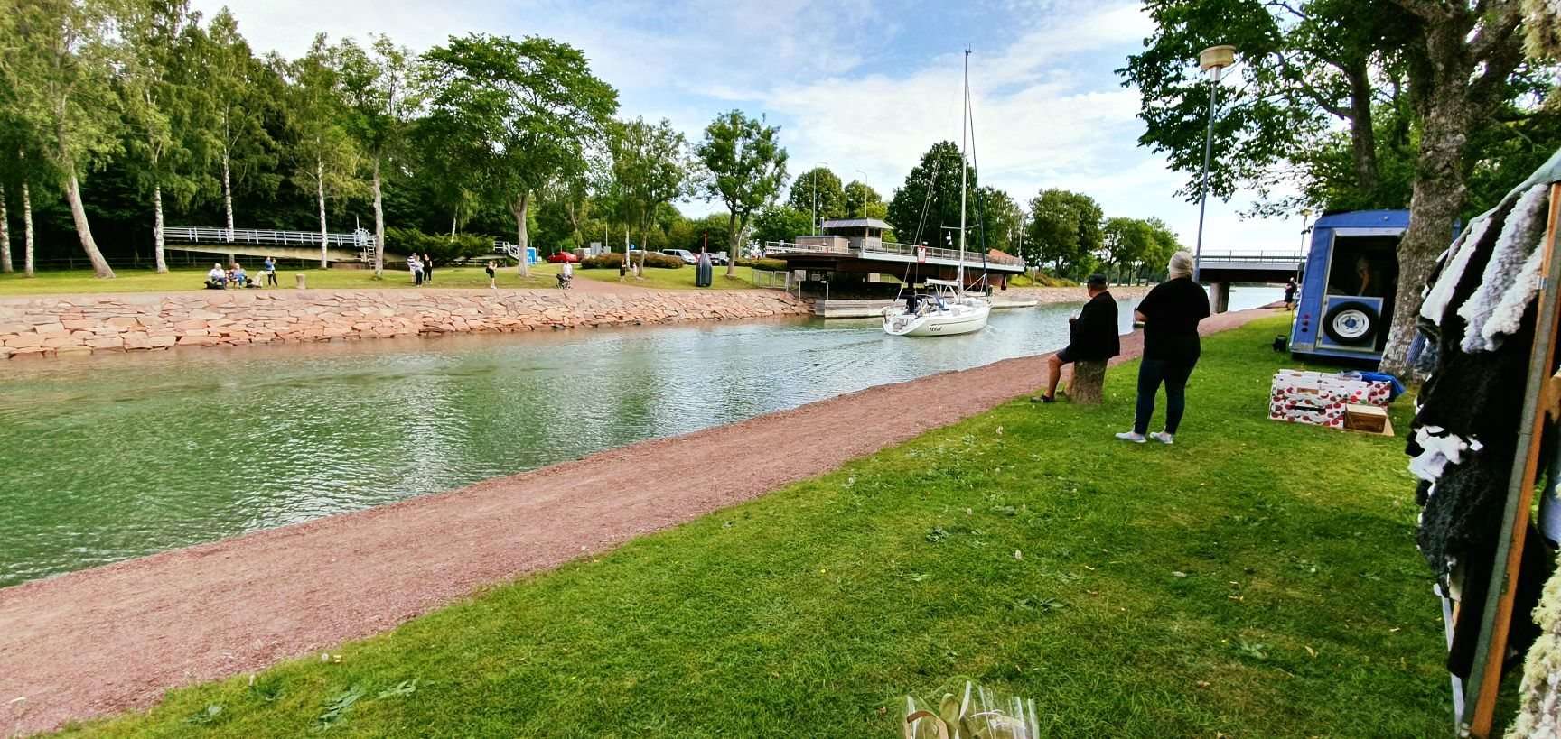
It depends on what you want to do. For swimming, boats at the Lemström canal and long light evenings, July and August are the warmest months. June is the lightest but slightly cooler. September is still mild, with a mean of 13.1 °C at Nyhamn. Winter suits those looking for quiet and, with some luck, ice. Whatever the season, check the forecast on the day: the wind off the sea can quickly change how the weather feels.
Frequently asked questions
Where can I find today's weather in Lemland?
Today's forecast for Lemland is available from the Finnish Meteorological Institute (FMI), the Swedish SMHI and the Norwegian yr.no, all linked at the top of this page. FMI is Finland's national weather service and runs its own observation station in Lemland, Lemland Nyhamn.
How warm is Lemland in summer?
July and August are the warmest months, with a mean temperature of about 17 °C at Lemland Nyhamn over the 1991 to 2020 normal period. Inland, at FMI's Jomalaby station, the average daily high in July is 21.2 °C. The highest temperature FMI has recorded at Nyhamn is 28.8 °C, on 23 July 2025.
How cold does Lemland get in winter?
Winters in Lemland are mild by Nordic standards: February, the coldest month, has a mean temperature of -1.1 °C at Lemland Nyhamn. Cold spells still happen, and the station's record low is -29.2 °C, set on 10 January 1987.
Does it rain a lot in Lemland?
Annual precipitation at the nearest FMI station with rainfall statistics, Jomala Jomalaby, is 628 mm over the 1991 to 2020 period. Spring is driest, with 31 mm in April, and autumn wettest, with 74 mm in October.
Does the sea freeze around Lemland in winter?
It depends on the winter. According to FMI, the Archipelago Sea freezes in an average ice winter, while ice cover is far smaller in mild winters. Check FMI's ice conditions page for the current situation, and always assess the ice on the spot before walking on it.
How long are summer days in the Åland Islands?
Around midsummer the sun rises in Mariehamn shortly after 4 am and sets after 11 pm, according to the sun tables on gaisma.com, giving almost 19 hours between sunrise and sunset. At the winter solstice the day is just under six hours long.
Sources
- FMI: temperature statistics, 1991 to 2020 normals (archived December 2025)
- FMI: precipitation statistics, 1991 to 2020 normals (archived October 2026)
- FMI open data: daily values, Lemland Nyhamn, July 2025
- FMI open data: daily values, Lemland Nyhamn, January 1987
- FMI: ice winter in the Baltic Sea
- Wikipedia: Lemland (climate table)
- Gaisma: sunrise and sunset in Mariehamn
- FMI: weather in Lemland
- SMHI: forecast for Lemland
- yr.no: forecast for Lemland
- FMI: ice conditions